29 November 2021
“The potential for significant resource expansion and discovery at Angilak is exceptional, including 14 targets with high-grade U3O8 drill intercepts which span 60 kilometres of underexplored prospective geological trend,” stated ValOre’s Vice President Exploration, Colin Smith. “ValOre is preparing a multi-faceted and fully funded 2022 exploration program to rapidly expand and advance the project, supported by the recently-closed and oversubscribed C$11M financing.”
The 2022 Angilak exploration program will comprise a multi-faceted campaign including: core drilling, Enzyme Leach (“EL”) soil sampling, ground geophysics including ground magnetics and VLF-EM, and district-wide prospecting, mapping, and sampling. A property-wide targeting review has identified high-priority targets to be advanced in a fully funded 2022 exploration program, characterized into 3 target classes:
Complete geophysical and geochemical datasets have been re-processed, re-interpreted and re-integrated into the Angilak geological and targeting model. In addition, 466 square kilometres (46,600 hectares) of new WorldView spectral data and high-spatial resolution imagery covers 100% of the high-priority targets and prospective basin-margin. Key areas along two major trends have been identified for completion of ground magnetics, VLF-EM and EL geochemical sampling.
ValOre has closed a C$11M financing to support a significant exploration program at Angilak in 2022 (CLICK HERE for news release dated November 17, 2021).
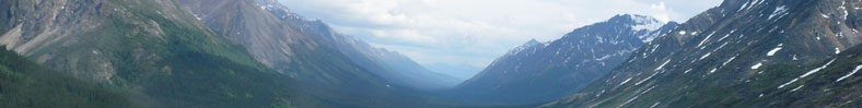
Angilak is a world-class advanced uranium exploration project with tremendous upside potential in a vastly underexplored district. The on-going property-wide targeting review has identified 34 targets to date, which are characterized into 3 classes: Resource Expansion, Target Advancement (ValOre-drilled high-grade U3O8 intercepts at pre-resource targets), and New Discovery (targets undrilled by ValOre). See Figure 1 below for a regional map of the Angilak Property, summarizing the locations and classes of the 34 targets reported herein, and the extent of additional planned ground magnetic and VLF-EM surveys and EL soil sampling.
The 2013 Lac 50 inferred mineral resource comprises 2,831,000 tonnes grading 0.69% U3O8, totaling 43.3 million pounds (“Mlbs”) of U3O8, representing Canada’s highest grade uranium deposit outside of the Athabasca Basin. In addition to uranium, the Lac 50 Trend contains significant quantities of silver, molybdenum and copper as outlined in the resource, and is interpreted as a basement hosted, vein-hydrothermal type, unconformity-associated uranium deposit. CLICK HERE for a summary table of the Lac 50 inferred resource estimate.
Lac 50 hosts significant resource expansion potential, with multiple high-grade U3O8 extension targets remaining wide open. Mineralization occurs as southwest plunging shoots, which have been traced by drilling to a maximum vertical depth of approximately 380 metres (“m”) and along a strike length of over 6 kilometres (“km”).
Lac 50’s J4 Zone (“J4”) contributes 15.3 Mlbs of U?O? grading 0.75% U?O?, 30.1 g/t Ag, 0.20% Mo and 0.26% Cu to the overall Lac 50 Trend resource. J4 remains entirely open down-plunge, and the re-processed ground VLF-EM data highlights a distinct off-set and interpreted continuation of the uranium-rich conductor immediately to the east-southeast of the resource zone. See Figures 2 and 3 below for a plan maps and 3D cross sections of J4, showing the fully open high-grade U?O? shoots at depth, and the potential for continuation of the J4 and Ray zones along their interpreted fault offset to the west.
Similar resource upside has also been identified at Lac 50’s Eastern Extension (“EE”), Western Extension (‘WE”) and Main Zone (“MZ”), all of which will be considered for targeted expansion drilling.
The Blaze Target (Figure 4) is located approximately 2 km west of the Lac 50 Trend. Mineralization occurs as complex pitchblende veins and disseminated sulphides in quartz-carbonate veins and breccia. The Blaze Target has been drilled across a strike length of 100 m, with significant mineralization intersected between 30 and 126 m depth below surface. A total of 3,466 m in 24 drill holes drilled in 2010 and 2011 investigated mineralization at Blaze. The most notable Blaze drill hole is 11-BZ-010 assaying 1.01% U?O? over 25.4 m. Subsequent drill holes suggest the true width of this intercept to be roughly 4 m. Blaze is untested by drilling for at least 1000 m to the west-northwest along a strongly anomalous uranium-in-soils trend (EL) and related to a 600 m VLF-EM conductor.
The RIB target (Figure 5) was identified as a basement conductor by Noranda Exploration Ltd. in 1976. During 1977-78, 14 of 25 diamond drill holes over a 1.2-km trend intersected uranium mineralization at shallow depths (less than 35 m), with the two best intercepts being 0.19% U3O8 over 9.3 m, including 0.52% U3O8 over 2.6 m and 1.61% U3O8 over 0.7 m. Exploration by ValOre in 2014 confirmed the RIB conductor using airborne VTEM geophysics. EL soil samples also outlined a corresponding 4-km-long uranium geochemical trend extending northeast, southwest and south of the historic Noranda drilling. Cobbles discovered south of the historic Noranda drilling near the anomalous EL soil geochemical samples assayed 5.34% U and lie on a parallel geophysical conductive trend approximately 500 m southeast of the conductor tested by the Noranda drilling. Planned ground magnetic and VLF-EM coverage will assist in better correlating the EL uranium anomalies with specific conductor targets prior to drilling.
The 59,483-hectare Angilak Property is situated in the mining- and exploration-friendly Nunavut Territory, Canada, and has district-scale potential for uranium, precious and base metals. Since acquisition, ValOre has invested over C$55 million on resource delineation and exploration drilling (89,572 metres in 589 drill holes), metallurgy, geophysics, geochemistry, and logistics across the large land package. This work supported the development of the significant Lac 50 Trend NI 43-101 inferred resource estimate (“Lac 50”).
The Lac 50 NI 43-101 Technical Report (effective date March 1, 2013) defined an inferred resource estimate which represents Canada’s highest-grade uranium resource outside of Saskatchewan, and one of highest-grade uranium resources on a global basis. Highlights include: